
Thousand Oaks ZIP Coverage by Code
Four ZIP codes form the verified core of the Thousand Oaks search area, but their postal identities do not line up neatly with civic borders. The USPS routing table associates 91360 and 91362 with Thousand Oaks and 91361 with Westlake Village. The city and county sources add Newbury Park, Lake Sherwood, and the eastern edge to the research picture. Treat the table as a starting map. For a live answer, match the full street address to the current USPS result before you sort any name, parcel, or mailing record.
| ZIP Code | Areas Covered | Post Office | Notes |
|---|---|---|---|
| 91320 | Newbury Park and western Thousand Oaks | Newbury Park | Search both postal and city place names |
| 91360 | North and central Thousand Oaks, including Wildwood vicinity | Thousand Oaks | USPS routing associates it with Thousand Oaks |
| 91361 | Southern and eastern edge, Westlake, Lake Sherwood vicinity | Westlake Village | Postal and civic labels can diverge |
| 91362 | Eastern and northeastern Thousand Oaks, Westlake-area addresses | Thousand Oaks | USPS routing associates it with Thousand Oaks |
| 91319 | Newbury Park routing group | Newbury Park | Legacy or special status not verified |
| 91358 | Newbury Park routing group in an older USPS table | Newbury Park | Legacy or special status not verified |
| 91359 | Thousand Oaks and Westlake Village service-area references | Thousand Oaks routing | Current special or PO-box status not verified |
| 91363 | Westlake Village and Thousand Oaks edge | Thousand Oaks or Westlake routing | Shared edge code with Los Angeles County context |
The last four rows are deliberately cautious. Research did not verify a current street-level classification for each code, and no local source established a complete list of unique or PO-box-only assignments. Do not turn a legacy label into a claim about a present parcel. Use the USPS ZIP Lookup for the live check.
Note: Postal routing tells a carrier where to deliver; it does not decide which government office holds a land or court record.
Thousand Oaks ZIP 91320 and Newbury Park
91320 is the clearest local example of a postal name that needs context. Newbury Park is a community and mailing identity used in the wider Thousand Oaks records landscape, so a name search that accepts only “Thousand Oaks” can miss a useful place term. The reverse problem also occurs: a database may return the city name for an address whose delivery label is Newbury Park. Record the postal city exactly as shown, then keep it separate from the municipal location.
The city’s water-provider information also shows why service geography should not be treated as a ZIP map. Newbury Park and Westlake-area addresses appear in a broader service discussion, while the city limits layer answers a different question. For family research or returned mail, search the place variants “Newbury Park,” “Thousand Oaks,” and “Conejo Valley” when the source permits text search. That expands recall without claiming that every matching address sits in the same jurisdiction.
Thousand Oaks ZIP Search Checks
No verified local portal was found that accepts a ZIP and returns a complete Thousand Oaks resident directory. The Ventura Assessor interface is an official property source, but its interactive ZIP fields were not verified during research. The City GIS service publishes useful layers, yet its records describe geography and parcels rather than a roster of occupants. A careful ZIP code directory therefore starts with validation and then chooses the custodian that matches the question.
| Control or field | What it does | Limit to keep in mind |
|---|---|---|
| USPS By Address | Uses street address, city, and state to return a ZIP and ZIP+4 | Best for one complete address |
| USPS By City and State | Returns ZIPs associated with a postal city | Postal association is not a city-limit test |
| City GIS Zipcode layer 15 | Maps or queries the city ZIP layer | Compare it with a separate limits layer |
| City Limits layer 35 | Shows the incorporated boundary | It is not a delivery-route layer |
| Addressing Grid layer 38 | Provides a municipal addressing reference | Keep it separate from postal labels |
| Adjacent Cities layer 41 | Provides neighboring-place context | Helpful at the Westlake and county edge |
| FeatureServer query | Exposes the city base-data layers for map or JSON queries | Published maximum is 2,000 records |
Finding Thousand Oaks Names by ZIP
A ZIP code can narrow the search, but each next step must state what the source actually proves. Start with a full address when one is known. If the goal is a broad geography question, use the city layers to mark the ZIP area, then move to parcel or record sources without treating the map as a people list.
- Verify the full address with USPS. Save the returned ZIP and ZIP+4, along with the postal city spelling.
- Open the City of Thousand Oaks base-data service. Compare Zipcode layer 15 with City Limits 35, Addressing Grid 38, and Adjacent Cities 41.
- Resolve a parcel through the Ventura Assessor or County View when an address or APN is available. The assessor can establish an owner record; GIS can establish parcel shape and location. Neither alone establishes every person at an address.
- Use a California voter-file request only for a qualifying statutory purpose. The public voter-status form is a self-lookup, not a ZIP-wide name search.
- Keep a note of the source, date, postal city, and parcel key. A result set that reaches the service’s 2,000-record maximum should not be read as a complete census of names.
When the ZIP has narrowed the geography and the question becomes a named road, the next useful unit is the address. That shift keeps a ZIP code directory from overstating what postal data can show.
Thousand Oaks GIS ZIP Layers
The City of Thousand Oaks base-data service is valuable because it keeps several kinds of geography visible at once. A ZIP layer answers a delivery question. City Limits answers an incorporation question. Addressing Grid supports local street reference, while Adjacent Cities supplies edge context. The service lists those layers separately rather than presenting a blended “Thousand Oaks” outline.
The official City GIS FeatureServer is the source behind the captured layer view below. Its record maximum is 2,000, so a large query needs care before any count or boundary conclusion is drawn.
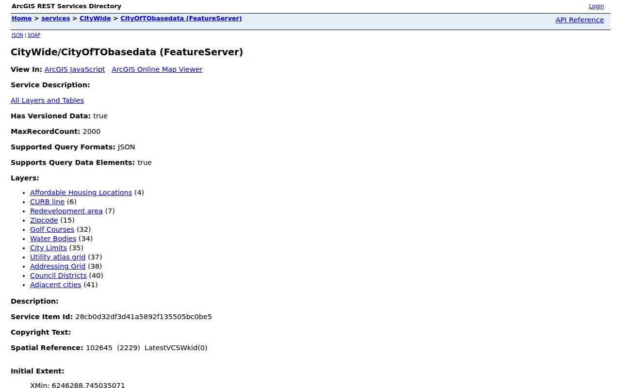
Use the layer names as a checklist. If a postal label and a civic boundary disagree, preserve both values and send the legal or ownership question to the county custodian.
Postal ZIP Boundaries vs Thousand Oaks
ZIP boundaries are built for delivery. City limits are legal municipal lines. The two can cross in the Thousand Oaks area, especially around Newbury Park, Westlake, Lake Sherwood, and the eastern approach toward Los Angeles County. A 91361 mailing label may say Westlake Village even when the research question concerns the Thousand Oaks edge. A 91320 label can point to Newbury Park while county and city records use a wider local geography.
Boundary check. Keep postal city, ZIP, situs address, and municipality in separate fields. The USPS result controls delivery verification; the city limits and parcel layers control local geography.
For a property question, preserve the Assessor’s situs and APN, not just the tax-mailing ZIP. For a civic question, check the appropriate city or county layer. For a family or news search, repeat the likely place names, then confirm the person or event through the underlying record.
Thousand Oaks ZIP Address Keys
Postal terms can sound precise while hiding different levels of detail. These definitions help keep a ZIP code directory clear about what its fields mean.
- ZIP code
- A five-digit postal delivery area. It is a route label, not a statement of municipal jurisdiction.
- ZIP+4
- Four extra digits that narrow delivery within a five-digit ZIP for a specific address or route.
- PO-box ZIP
- A code assigned to post-office boxes or a special postal use. The current classification must be verified for the address in question.
- Unique ZIP
- A code reserved for a single organization or institution. No local source verified a complete Thousand Oaks list of these codes.
- Carrier route
- A delivery path inside the postal system. It can be more exact for mail service than a city label, but it is not a parcel or resident roll.
Special ZIP Codes Around Thousand Oaks
91319, 91358, 91359, and 91363 appear in older routing or county service references tied to the Newbury Park, Thousand Oaks, and Westlake edge. The research did not verify whether each is currently street-wide, PO-box-only, unique, or used only in a special routing context. That gap matters. A legacy code in a data export can be a historical field rather than a live delivery answer.
Check each code with the current USPS tool when a full address is available. If the code comes from a deed, assessment notice, newspaper entry, or old directory, retain it as written and add a second, current postal check. This two-date approach protects a family-history search from quietly rewriting an older record.
Note: A legacy ZIP can preserve useful history, but it cannot by itself prove that a parcel or person remains in the same postal area.
From ZIP to Thousand Oaks Streets
A ZIP is a broad filter. Once the postal check is complete, a named street and full address give the county parcel and city record systems a better key. That is the point to preserve the situs address, APN, mailing address, and any legal description as separate values. It also helps prevent a Newbury Park or Westlake postal label from being mistaken for a different land jurisdiction.
For street-level work, continue with the Thousand Oaks street directory, where the address chain can be compared with County View, the Assessor, deeds, TO/24 permit records, and the historical address directories. The ZIP code directory remains useful as the first geographic cut, but the parcel and custodian determine what a record can support.